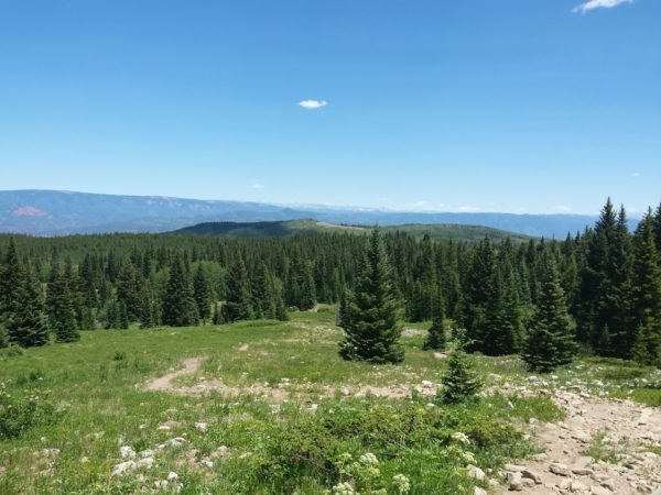
Trails Near Glenwood Springs
Glenwood Springs is a scenic place for hiking and biking. It seems all trails near Glenwood
Springs lead to beautiful vistas and views. It’s not uncommon to find yourself at the top of a
trail staring down at the Colorado River or south to Mt. Sopris.
Two trails that accomplish this are the Boy Scout trail and the Glenwood Canyon overlook
trail. The Boy Scout trail is accessible to both hikers and bikers. It begins at the eastern end of 8th
street and from there is a steep singletrack climb. While many do ride it this way as an out-
and-back, it can also be combined with the Forest Hollow Trail and the Rio Grande Trail for a
long loop ride. For hikers, be on the lookout for bikes as you ascend to a great lookout at
Artist’s Point. The best thing about the views from here? You get a spectacular look at the
rides at Glenwood Adventure Park!
The Glenwood Canyon overlook trail is a short 3.2 miles and begins at the eastern end of
Glenwood Canyon. Park at Dotsero and follow the bike path west for about half a mile. The
trail begins here. This trail is an old double track, now closed to traffic, that offers beautiful
views of the Colorado River corridor from its summit. It’s open to both hikers and bikers.
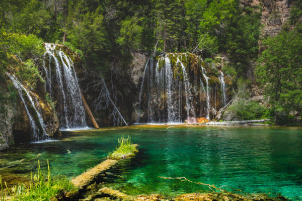
For the most well-known hike near Glenwood Springs, you’ll need to make some plans.
Hanging Lake now has a reservation system.
It’s easy to use and you’ll meet at the Hanging Lake Welcome Center for your shuttle ride to
the trailhead. Though steep, most people make it to the top because they know the gorgeous
“hanging” lake scenery that awaits them. Be prepared with water and snacks for this 1.2 miles
(one way) hike.
If you head south through Glenwood Springs on highway 82, you’ll find many more trails near
Glenwood. The Red Canyon area is home to the Grandstaff and Jeanne Golay trails. This is a
popular recreation area for both hikers and bikers and, in addition to the two trails mentioned,
includes quite a few technical trails. For most, Jeanne Golay is a great way to get up the
mountain. It has a consistent grade and shade too. Then bikers head down the fun and
flowing Grandstaff trail and earn every minute of this awesome downhill! Hikers beware:
Lower Grandstaff is for biking only.
If you’re up for exploring more trails near Glenwood Springs, head south to Carbondale. It’s a
short drive to this quaint little town. From highway 82 head south on highway 133 and turn left
onto Prince Creek Road. The next several trails will all be from this area.
Thomas Lakes – The Thomas Lakes trail is at the top of Prince Creek
road. While some bikers do use it, most of the traffic here is hikers. You can backpack in this
area if you want, but a permit is required. Most do this hike as an out-and-back and it ends up
being about 8 miles long. The hike starts out in forest but eventually opens up into meadows
in the Mt. Sopris basin. You’ll hike up a few steep hills along the way before finding yourself
peering through trees at crystal clear water. Turn around here or hike on for a bit more
exploration around the lakes themselves.
If you don’t want to drive that far or hike that long, park in the first parking area on your right
after you turn onto Prince Creek. From here you can easily access the Monte Carlo trail. For bikers, this is a
great way to climb from the base of The Prince Creek trails up to other trails like Christmas
Tree, North and South Porcupine, and Father of Ginormous. The most important piece of
advice we can give you about these trails is to use a trail app and know the elevation gain.
There are some trails here, like Outie, that you do not want to climb!
Trails near Glenwood Springs are plentiful! Whether you’re looking for something close to
town or want to explore further south, you’ll find a great trail for hiking or biking. There is a
good chance it will have amazing views too.